North Mill Pond History
Most historical pieces are usually written centering around a certain person or event. Here we want to tell a story from the perspective of a body of water - the North Mill Pond. Imagine the changes it has seen over the centuries...
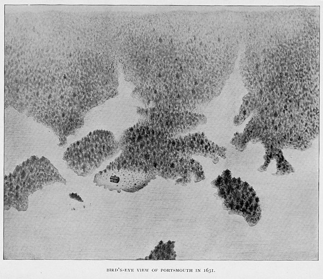
When the first Europeans arrived early in the 17th Century, North Mill Pond was a tidal inlet off the Piscataqua River with thickly wooded shores. The mighty old-growth trees of New Hampshire's forests were prized by the English Crown for their use as ships masts. Many of the first settlers came to New Hampshire, not in search of religious freedom but rather to seek their fortunes through trade with England, primarily in fish, fur, and timber.
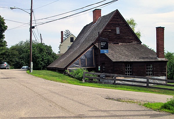
In the great land division of 1660, land grants were finally given on the shores of the North Mill Pond. Richard Jackson, a cooper by trade, was given a 25 acre grant on the north side of the pond. The house he built in 1664 still sits on a hill above the pond on Northwest Street.
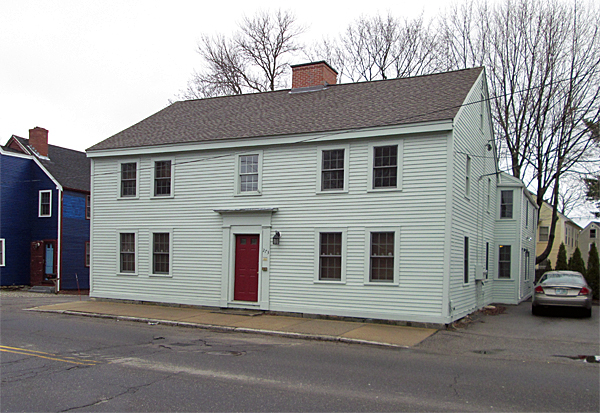
The Timothy Waterhouse House, sometimes known as the Waterhouse-Ham House, is located at 273 Maplewood Avenue, on the northwest corner of Maplewood Avenue and Dearborn Street. Timothy Waterhouse, a Portsmouth native employed as a tanner and shoemaker, was born in 1675. He built this home around 1700; however, its original location was about a half-mile north on Freeman’s Point. At that time, the headland was named Ham’s Point for the original owner, William Ham. Timothy married Ruth Moses in January 1700, and the Waterhouses had eleven children together. In 1725, there were nine rambunctious children living in this small home (six girls and three boys), from ages four to seventeen. There’s a local story about the time the kids were home alone, enjoying a rowdy evening in the absence of their parents. They could make all the noise they wanted, because the house was isolated, and there was a snowstorm blowing outside. Suddenly, there was a loud knocking at the door! All of the siblings abruptly hushed themselves: Margaret, Mary, Ruth, Joseph, Timothy, Sarah, Elizabeth, John, and Lydia. The bravest and oldest, Margaret, must have been apprehensive as she walked to the door and swung it open. In the dark doorway stood an apparition dressed all in white, with a black face. Thinking The Devil himself had come calling, Margaret immediately fainted. The visitor proved to be an African slave owned by another tanner, Nathaniel Jackson, who had been sent to retrieve Mr. Jackson’s shoes – possibly a new pair crafted by their father. The Timothy Waterhouse House moved to its present location on Maplewood Avenue around 1765 and remains a private residence.
In 1803, local Joiner John Miller, "an enterprising, capable architect", laid out the development encompassing Sparhawk to Woodbury. When he died in 1813, he had lumber waiting on the southern shore where he planned on building a bridge from the Rock Pasture across the pond to Sparhawk. The bridge was never built.
The only water powered mill in Portsmouth was operated on the west end of North Mill Pond. The Stocking and Yarn Factory was located on Islington Creek (today Hodgdon Brook at Bartlett & Cate streets) in 1834. When that factory burned five years later, it was replaced under new owners as part of the Rockingham Steam Factory. Some 220 men, women, girls, and boys eventually found employment at this company, working directly at the factory or from their home as “seamers and finishers.” Up to 1,200 pairs of stockings could be manufactured per week.
Around 1840, to accomodate several railroads needed to connect Portsmouth to Massachusetts and Boston, the south side of North Mill Pond was partially filled in, and an industrial neighboorhood evolved around one large cotton textile mill and several other small industries.
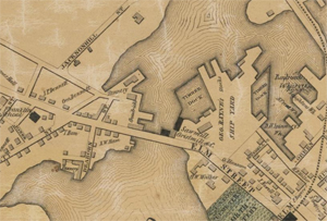
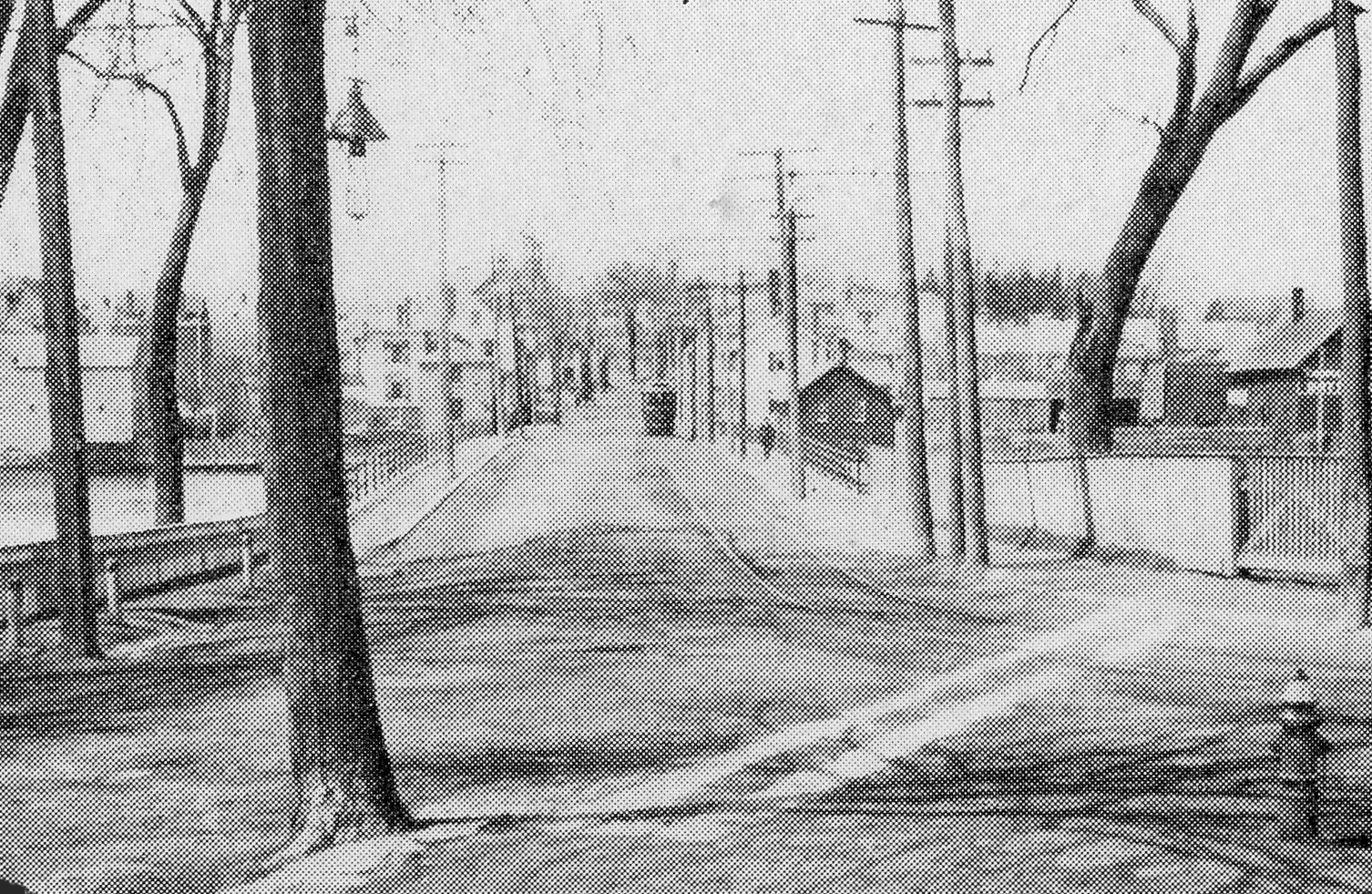
In 1850, the Rayne's Shipyard dominated the beginning of North Mill Pond. The Causeway across the Pond was then call Elm Street (now Maplewood).
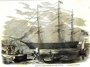
George Raynes purchased the property called the Rayne's Shipyard in 1832 and turned the shipyard into a booming business. From 1832-1855, he constructed from sixty to seventy ships of all sizes. Some of the largest and fastest clipper ships that ever sailed were constructed at the Raynes shipyard, including the Sea-Serpent (1850), the Witch-of-the-Wave (1851), the Webster (1853); and the Sierra Nevada and Coeur de Lion (1854).
In 1850, the Portsmouth Steam Company manufacturing cotton textiles and the Sagamore Mill occupied the southern shore of North Mill Pond.
Built in 1850, the six-story Portsmouth Steam Company was a huge presence on the south shore of North Mill Pond. Over 400 people were employed in the manufacture of cotton fabrics. In 1866, it was reorganized into the Kearsarge Mills. On Dec. 4, 1880, the mill was ravaged by a fire described in Portsmouth Fire Department historical records “as the worst public calamity since the Great Fire of 1813.” The fire destroyed the building’s top five floors, leaving only the ground level floor. The owners decided not to rebuild, and the empty ruin was sold.
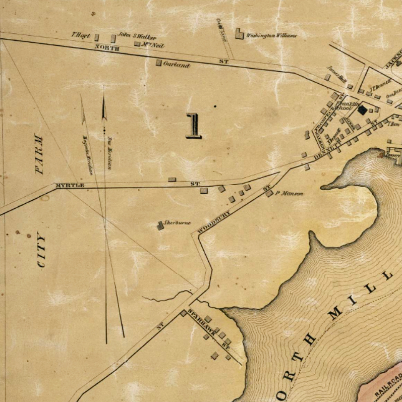
In 1850, there were few houses and streets on the north side of North Mill Pond. Dennett Street ended at the fork of Myrtle and Woodbury (that section is now Thornton Street).
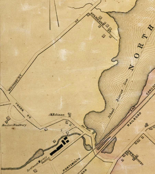
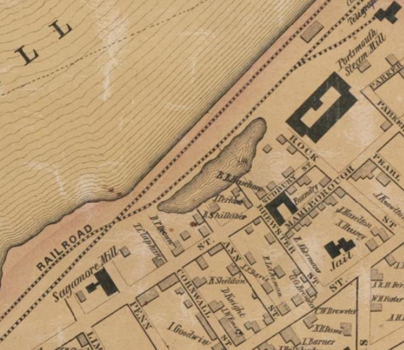
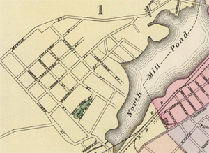
As you can see from this Map of 1850, the northern Creek area was still largely vacant, with nothing between Sparhawk and Bartlett Streets. The Rockingham Steam Factory is at the bottom.
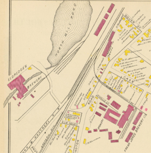
After the Civil War, thanks to entrepreneurs like Frank Jones and Herman Eldredge , Portsmouth became synonymous with beer, delivering the nation’s largest output of beer (100,000 gallons per year) across the country. Beer production dominated the West end of North Mill Pond.
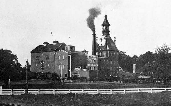
The Eldredge family began brewing in the former Portsmouth Stocking Factory on the North Mill Pond West End around 1858, and the M. Fisher Brewing Company soon opened with Marcellus Eldredge in charge. His father, Herman Eldredge, bought the firm in 1870 and renamed it the H. Eldredge and Son Company. They shortened the name to the Eldredge Brewing Company in 1875. Eldredge Brewing Company produced 30,000 barrels of beer in 1870 and grew to almost 93,000 barrels of beer by 1892. It was the second largest brewery in Portsmouth, after the Frank Jones Brewery. (Today, the original ice vault for beer storage from the Eldredge Brewing Company is now the office building called Eldredge Park at One Cate Street)
By 1877, most of the streets of the Creek Area of North Mill Pond had been laid out.
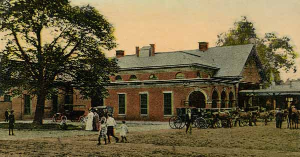
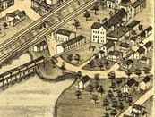
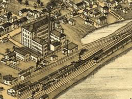
Located on the south side of North Mill Pond The Boston & Maine railroad station in Portsmouth, N.H. was once the end of the line for passengers coming from Boston.
This crash knocked the engine directly onto its side in Portsmouth, N.H. station on August 12, 1894.
The last mill on the Maplewood causeway ceased operation in 1888, more than 200 years after the first mill built by John Cutt in 1659.
From 1899 to 1925, the Portsmouth Electric Railway operated the local electric trolleys, with a track that went right over the Maplewood Causeway. It was even possible to take a trolley all the way to Concord, but it took 7 hours! Sadly, the trolleys were discontinued in 1925.
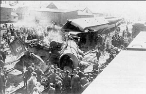
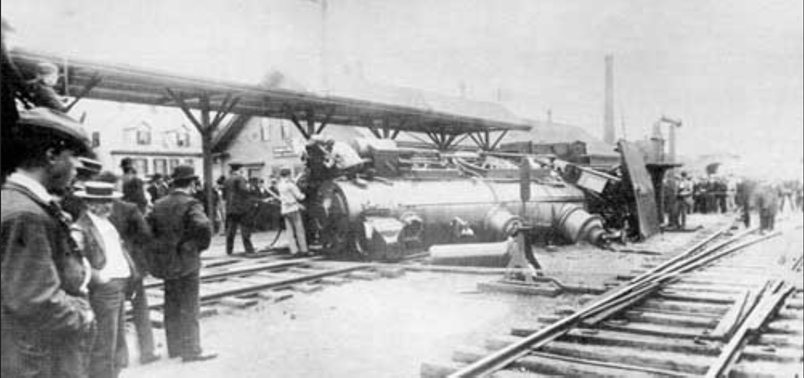
A crash at the Portsmouth, N.H. station made headlines in May 1909 when one B&M passenger train rear-ended another at noon. Seven people were injured and fireman on the yard engine was killed.
The US 1 Bypass was bui;lt in 1940, part of a major New Deal project to move U.S. Route 1 traffic away from the congested streets of downtown Portsmouth. The Bypass created a second Piscataqua River crossing into Maine via the Interstate (Sarah M. Long) Bridge. The highway's wide divided lanes and grade separations were the first in the state, earning it the title 'New Hampshire's Most Modern Highway.' Today, the U.S. Route 1 Bypass is one of the oldest signed bypasses in the country's numbered route system.
Sources
Richard Candee has been president of the Portsmouth Atheneum and the Portsmouth Historical Society, was the author of "Building Portsmouth", and is professor emeritus of American and New England Studies at Boston University.